 RiderLog
Sunset spot
Sichan Pradit Bridge ViewpointBridge + sea/coast.
Where the Chao Phraya finally reaches the sea, an hour south of the old town. The pins out here are coastal temples reached through mangrove, a fort museum on a river island, and flat causeways over shrimp farms that make the best sunset run out of Bangkok. This is a ride rather than a detour, so leave with a full tank.
Every pin here is on the city map too. Open Samut Prakan and the River Mouth on the full Bangkok map, or drag the map above and the address bar keeps your view.
Bridge + sea/coast.
Bridge + coastal landscape.
Samut Prakan riverside - local river life.
Photo: Supanut Arunoprayote / CC BY 4.0 via Wikimedia Commons (resized)
Historic Samut Prakan riverside chedi.
Mangrove / coast viewpoint.
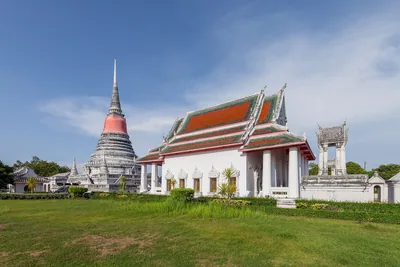
A Buddhist temple in Pak Nam, Samut Prakan - historic origins, traditional Thai temple architecture, and a peaceful stop for visitors interested in the area's religious heritage.
A local temple within a network of nearby temples in Phra Samut Chedi district - a convenient stop for exploring the local communities rather than a major tourist attraction.
A neighbourhood temple in Phra Samut Chedi District, Samut Prakan - a local place of worship and community activity.
Photo: กสิณธร ราชโอรส / CC BY-SA 4.0 via Wikimedia Commons (resized)
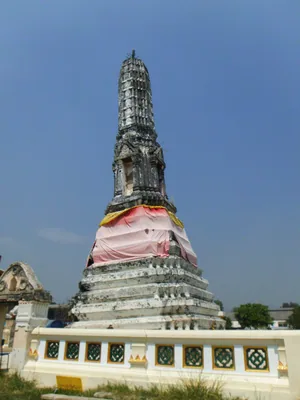
Best known for its leaning Khmer-style prang, tilting roughly 15 degrees west. The ground subsided over a century ago, yet the tower has remained stable ever since.
Photo: Charin ninsu / CC BY 3.0 via Wikimedia Commons (resized)
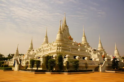
A completely different visual experience: 13 white stupas arranged together, with strong Burmese architectural influence. Also an important meditation center.
A temple in a coastal community where the coastline has moved dramatically inland.
Wat Khun Samutrawat and the disappearing village - the story of coastal erosion.
Photo: Supanut Arunoprayote / CC BY 4.0 via Wikimedia Commons (resized)
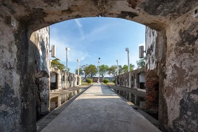
Old coastal fortress, mangrove, long wooden walkway, sea landscape and military history - the fort sits on a small island area at the mouth of the Chao Phraya, with a nature walk through the mangrove.
All 13 places in Samut Prakan and the River Mouth are pinned above. The whole Bangkok layer is in RiderLog: every pin with its story and exact location, check-ins with photos, and the lists riders you follow are building. Record the ride there and back, and it turns into a card worth sending. Free on the App Store.
Mapped by riders who rode here, on check-ins rather than star averages. No sponsored pins, ever.
Aivars Meijers. I am from Latvia, I live in Bangkok, and I build apps on my own as SleepyBytes. RiderLog is the app I use myself every time I take the scooter out, and I share how it is going, numbers and all, on YouTube.
Also by me: Apnea · Box Breathing · Bike Identifier · Ramen Number · Earn Your Scroll · aivarsmeijers.com